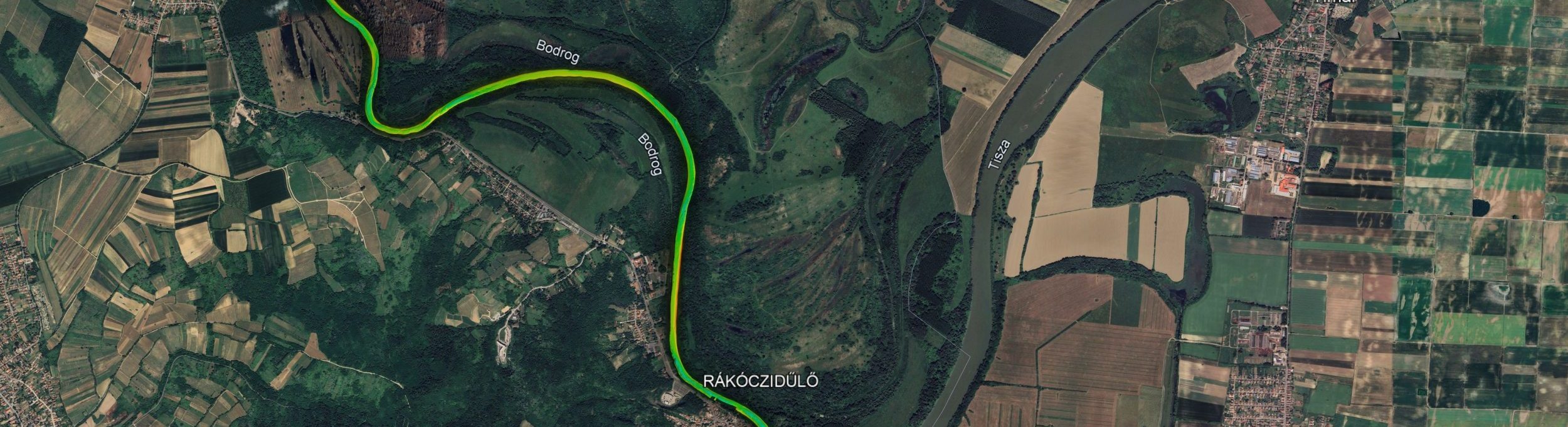
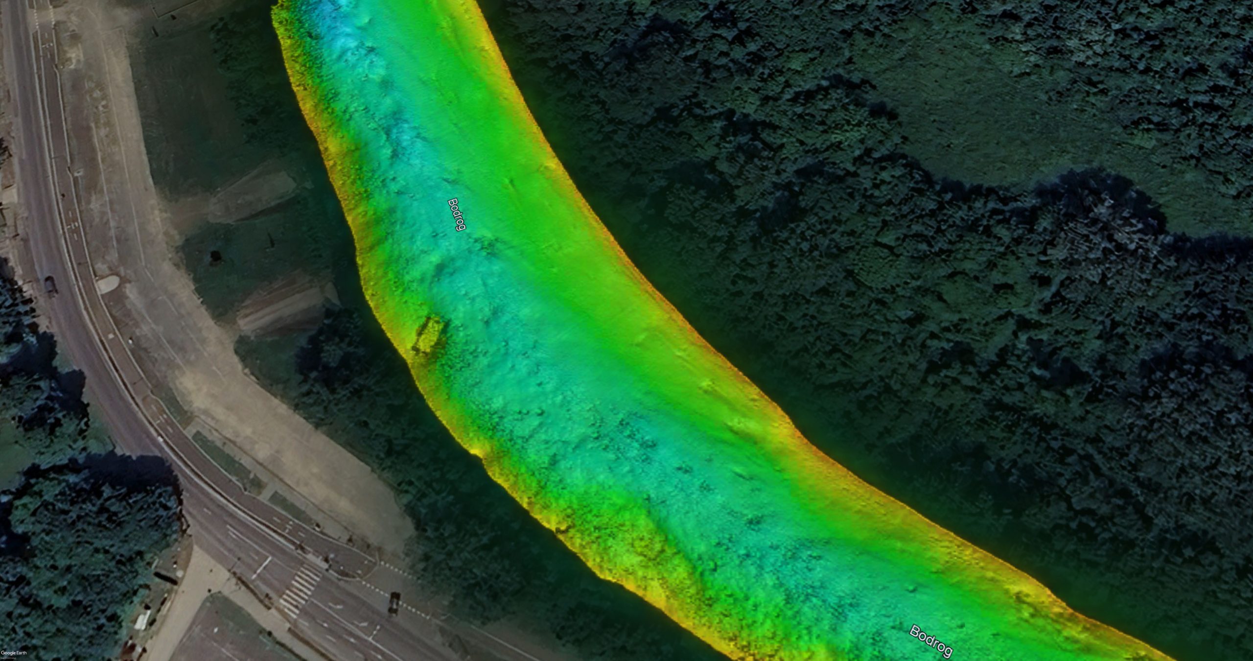
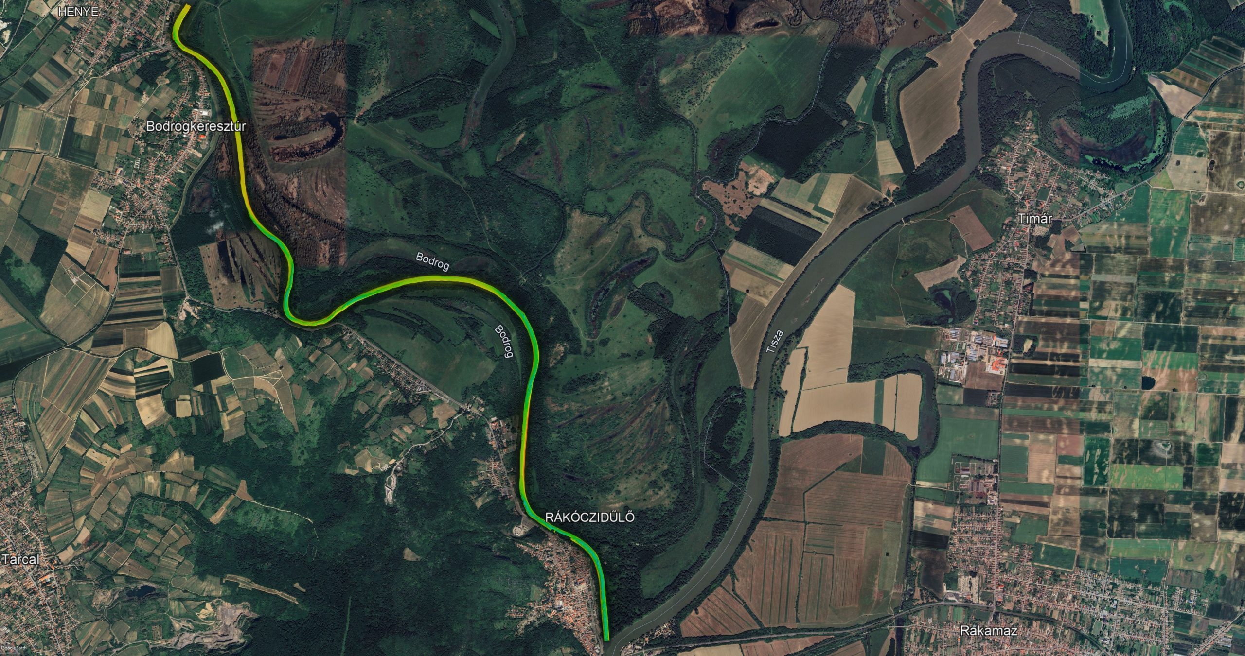
Bodrog River – Confluence with the Tisza

In late 2025, we conducted a high-precision 3D bathymetric survey along an approximately 9-kilometre r

each of the Bodrog River, commencing at its confluence with the Tisza River. The survey was undertaken in preparation for a planned in-water engineering project, for which an accurate and up-to-date assessment of riverbed conditions was essential.

Multibeam echosounder technology was deployed to achieve full-coverage, high-resolution three-dimension

al mapping of the riverbed. This methodology provides a detailed representation of bed morphology while simultaneously identifying submerged objects, obstructions, and other underwater features that are not detectable by visual inspection.

The survey results revealed, among other features, the clearly defined outline of a previously sunken pontoon resting on the riverbed. This finding illustrates the extent of concealed subsurface information that may significantly influence the planning and safe execution of subsequent works.

The resulting high-resolution bathymetric model constitutes a primary technical basis for the planned in-water operations at the site. Accurate riverbed data are indispensable for the responsible planning of equipment deployment, positioning, and construction methodology.

In water-related projects, one of the most critical phases often precedes physical execution: the systematic identification and assessment of subsurface conditions.

Request a quote

If you are interested in our services and equipment and would like to plan your future projects with us, please ask for a quote.